


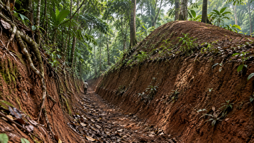

If you stood inside the deepest surviving section of Sungbo’s Eredo, the forest floor would rise above you like the wall of a sunken road. Roots would grip the red earth. Leaves would soften the light. Unless someone explained what you were looking at, you might mistake the monument for a natural valley.
It is not natural.
People cut this enormous ditch through the landscape around Ijebu-Ode and piled the excavated soil into an adjoining bank. The result was a boundary that crossed forest, settlement routes and wetlands on a scale that is still difficult to hold in the mind.
Nigeria’s submission to UNESCO’s Tentative List describes an earthwork about 150 kilometres long and reaching roughly 15 metres in depth in places. Archaeological publications based on other surveys often give a figure closer to 160 or 165 kilometres. The exact measurement varies, but the central fact does not: Sungbo’s Eredo is one of Africa’s most extraordinary surviving earthworks.
It is also an argument written into the ground. Long before colonial rule, a society in the forest zone of southwestern Nigeria could plan, organise and sustain labour on a monumental scale.
What exactly is Sungbo’s Eredo?
Sungbo’s Eredo is a vast system of ditch and embankment associated with the historic Ijebu Kingdom. It passes through parts of present-day Ogun and Lagos states and is especially connected with communities around Ijebu-Ode and Oke-Eri.
The word “wall” is often used in popular descriptions, but it can create the wrong picture. This is not a continuous stone barrier like a castle wall. Builders dug into lateritic soil and placed the removed earth beside the ditch. The bank increased the total height that a person approaching the boundary would have to cross.
Its form changes with the terrain. Some sections appear as deep, steep-sided cuts. Others are more recognisable by the raised mound. Erosion, farming, road construction and vegetation have altered parts of the system, while other stretches remain strikingly visible beneath the forest canopy.
The monument should therefore be understood as a landscape rather than one isolated attraction. It linked places and communities across a wide territory.
Why build a ditch and bank on this scale?
No surviving document tells us that the builders had only one purpose in mind. Archaeologists and historians consider several functions that may have worked together.
- Defence: a steep ditch and bank could slow attackers and make movement easier to watch.
- Territorial definition: the earthwork could mark the reach of political authority and distinguish an organised inside from the land beyond it.
- Control of movement: openings and crossing points could help direct travellers, traders and goods through routes monitored by local authorities.
- Social statement: a monument this large announced that the society behind it could mobilise labour and maintain cooperation across many communities.
Calling it a defensive fortification is reasonable, but defence alone does not explain everything. A boundary can protect, tax, guide, exclude and communicate power at the same time.
This is where Sungbo’s Eredo connects to the larger history of the Ijebu Kingdom. Ijebuland occupied a strategic position between inland Yoruba markets and routes leading toward the lagoons and Atlantic coast. The ability to organise space was inseparable from the ability to organise trade and political relationships.
How large is Sungbo’s Eredo?
The figures most often repeated are impressive, but they need context.
UNESCO’s Tentative List page records approximately 150 kilometres of earthwork and a depth of about 15 metres in places. Research by Olanrewaju Lasisi and David Aremu describes a circuit of roughly 165 kilometres and cites an estimate of 3.5 million cubic metres of moved earth and sand.
These figures are not necessarily contradictions. A monument that crosses a changing landscape is difficult to measure as if it were a straight modern road. Researchers may follow different surviving segments, include or exclude uncertain stretches, or record areas altered since earlier surveys.
The safest description is therefore both cautious and astonishing: Sungbo’s Eredo extends for roughly 150 to 165 kilometres, with some surviving sections deep enough to dwarf a person standing below the bank.
The scale matters because every metre represents human decisions—where to dig, how to move soil, how to organise workers and how to connect one section with the next.
Sungbo’s Eredo is not remarkable because it resembles a European wall. It is remarkable because its builders engineered authority through their own landscape, materials and institutions.
How could people have built it?
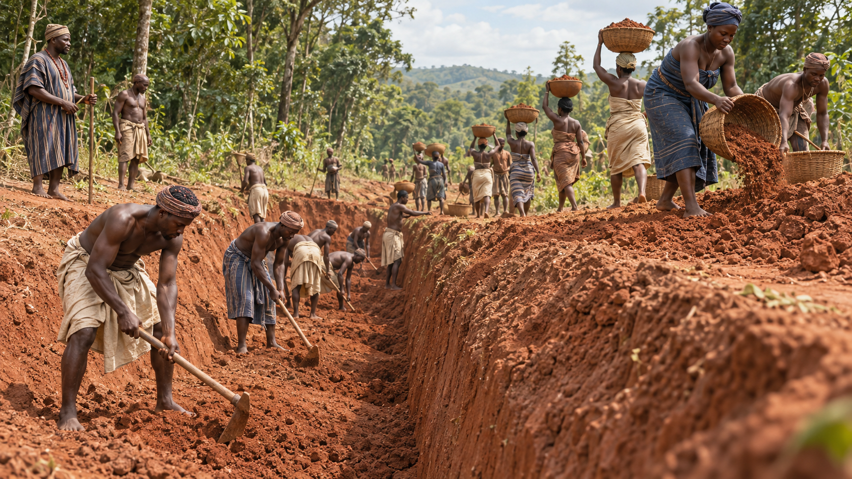
The earthwork was made without modern excavation machinery. That does not mean it was made without technology.
Laterite can be cut and moved with organised labour and suitable tools, but the work would still have demanded planning. Communities needed food, schedules, supervisors, specialist knowledge and agreements about where the boundary would pass. The project may have developed in stages rather than through one uninterrupted campaign.
A University of Ibadan study of ironworking sites at Odonoko and Imeri found evidence of substantial iron production near the earthwork. The researcher dated activity there to around the fifteenth century and proposed that the sites may have supplied tools used in construction.
That relationship remains a hypothesis, not a final verdict. Iron could also have supported farming and trade. Yet the evidence helps us ask a better question. Instead of wondering how people without modern machines could build the Eredo, we should ask what industries, institutions and labour systems made the work possible.
Go deeper into the culture behind the monument: explore the ÌJÈBÚ ALÁRÉ Heritage Mode and access the free digital archive.
When was Sungbo’s Eredo built?
The dating of Sungbo’s Eredo is one of the most interesting—and most frequently oversimplified—parts of its story.
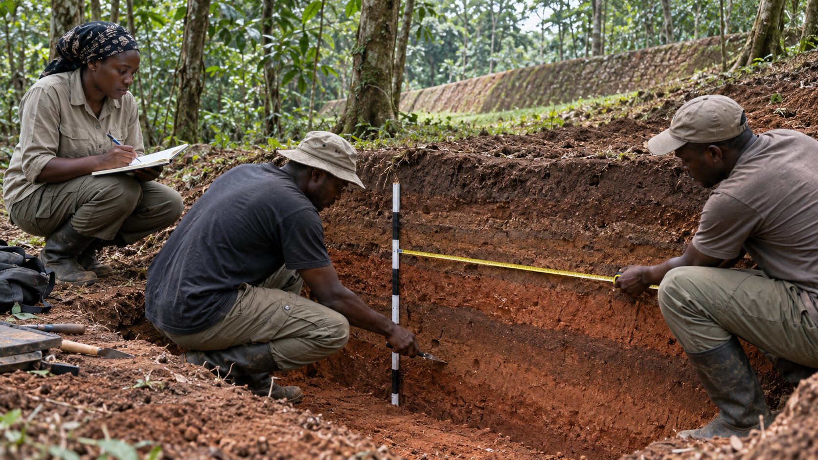
Earlier survey work associated with archaeologist Patrick Darling produced radiocarbon dates within the first millennium CE, including ranges around AD 670–1050. Other excavations have recovered much older material. But an ancient piece of charcoal beneath or inside moved soil does not automatically date the construction itself.
The problem is called context. When builders dig a ditch and pile up soil, they can move charcoal, pottery or stone tools that were already in the ground. A laboratory may accurately date the material while that date still belongs to an earlier occupation, not to the moment the embankment was made.
In their study, Lasisi and Aremu warn against confusing older material from beneath the monument with the construction date. Later interpretations have placed important building phases between the thirteenth and fifteenth centuries, while other researchers retain earlier dates for parts of the system.
The most responsible conclusion is not a single dramatic year. Sungbo’s Eredo may have been built, extended or maintained in multiple phases, and its chronology is still being refined.
Uncertainty is not a weakness in the history. It is evidence of archaeology doing its real work: testing claims against layers, materials and location rather than choosing the most exciting number.
What the Eredo reveals about precolonial Ijebuland
Whatever its precise date, the monument changes the way we should imagine political life in the West African forest.
For a long time, outsiders treated dense forest as an obstacle to complex societies. The assumption was that large states and monumental building belonged elsewhere—to stone cities, open savannahs or cultures already familiar to European writers.
Sungbo’s Eredo exposes the weakness of that assumption.
Its builders understood soil, drainage and terrain. They coordinated communities across a large area. They lived within networks that included farming, pottery, ironworking, trade and political authority. Their monument did not need imported stone or a European architectural shape to demonstrate complexity.
The earthwork is therefore more than an archaeological object. It is physical evidence that Ijebu state formation and urbanisation had deep local foundations before the Atlantic economy and colonial conquest transformed the region.
Who was Bilikisu Sungbo?
Archaeology is only one way communities remember a landscape.
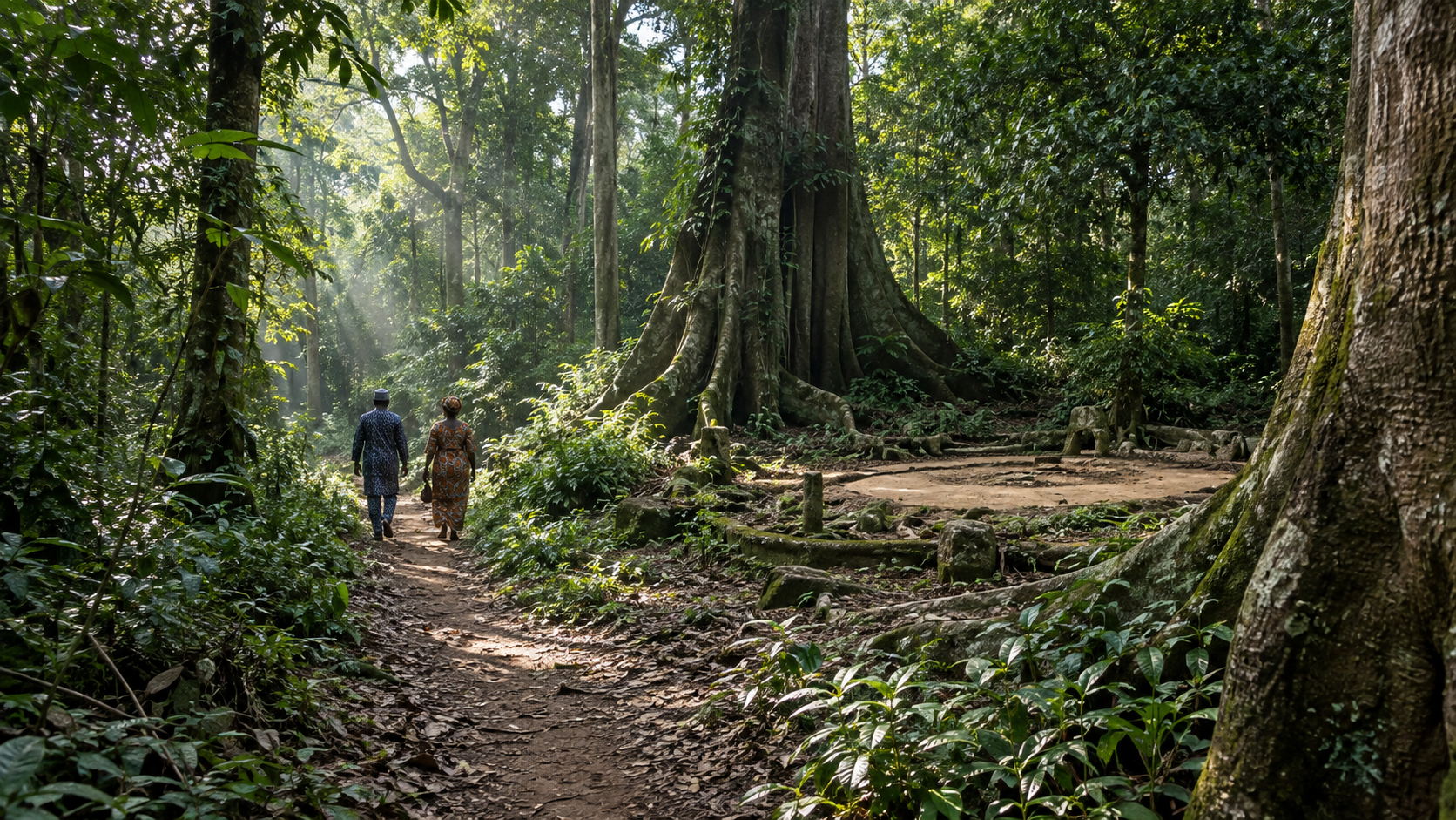
In Ijebu oral tradition, the Eredo is associated with Bilikisu Sungbo, a wealthy and powerful woman whose memory is tied to a sacred grove and reputed tomb at Oke-Eri. The name Sungbo’s Eredo—Sungbo’s embankment—preserves that relationship.
The tradition gives the monument a human presence. It connects an immense public work to generosity, wealth, authority and sacred memory. Visitors and pilgrims have continued to treat the grove as meaningful, demonstrating that a site can remain culturally alive even while scholars debate its chronology.
Oral tradition should neither be mocked nor flattened into a literal engineering report. It tells us how generations understood the place, who they believed deserved remembrance and how history became attached to the land.
Is Bilikisu Sungbo the Queen of Sheba?
Bilikisu Sungbo is often identified in popular accounts with Bilqis, the Queen of Sheba known through Islamic tradition, and with the queen who visits Solomon in the biblical account.
This identification is culturally important, but archaeology has not established that the historical Queen of Sheba lived in Ijebuland or built the Eredo. The chronologies proposed for the earthwork are also much later than the period traditionally associated with Solomon and the Queen of Sheba.
These points do not make the local tradition worthless. They simply place two kinds of knowledge side by side:
- Faith and oral memory explain how Bilikisu Sungbo became a sacred and powerful figure in the community.
- Archaeology examines the earthwork’s construction through excavated layers, materials and dates.
Respecting both means refusing two easy mistakes: presenting the Queen of Sheba connection as proven fact, or treating a living Ijebu tradition as if it has nothing to teach us.
Is Sungbo’s Eredo a UNESCO World Heritage Site?
Not yet.
Nigeria submitted “Benin Iya / Sungbo’s Eredo” to the UNESCO World Heritage Tentative List in 1995. A tentative listing means the country recognises the site’s possible outstanding value and may consider it for a future nomination. It is not the same as inscription on the World Heritage List.
The distinction matters. Calling the Eredo a UNESCO World Heritage Site would overstate its present status. Saying it is on Nigeria’s UNESCO Tentative List is accurate—and still significant.
The listing also points to a larger challenge. A monument made of earth and spread across many communities cannot be protected like a single building. Roads, farming, erosion, development and vegetation can damage sections before they are fully documented.
Preservation begins with recognition. People are more likely to protect a landscape when they understand that the ridges and ditches around them are evidence of an extraordinary shared history.
Why Sungbo’s Eredo matters now
The monument matters because it makes organisation visible.
We may never recover the names of most people who worked on it. We may continue to debate which sections came first and which ruler or institution directed them. But the earth itself records cooperation across generations.
That is the legacy carried by ÌJÈBÚ ALÁRÉ: prestige rooted not in empty display, but in the capacity to build, organise, adapt and remember.
Wear the story: view the ÌJÈBÚ ALÁRÉ Heritage T-shirt, a premium made-to-order piece inspired by Ijebu history and identity.
Sungbo’s Eredo facts at a glance
- Location: Ijebuland in southwestern Nigeria, crossing areas of present-day Ogun and Lagos states.
- Form: a long ditch paired with a raised bank of excavated earth.
- Recorded scale: roughly 150–165 kilometres, depending on the survey.
- Depth: up to about 15 metres in some official descriptions, with scholarly accounts reporting variations by section.
- Construction: human labour using local soil and tools; likely completed or maintained in phases.
- Dating: debated, with evidence requiring careful separation between older buried material and the construction event.
- Oral tradition: associated with Bilikisu Sungbo and the sacred landscape at Oke-Eri.
- UNESCO status: on Nigeria’s Tentative List since 1995, not yet a World Heritage inscription.
Frequently asked questions about Sungbo’s Eredo
Where is Sungbo’s Eredo located?
Sungbo’s Eredo lies in Ijebuland in southwestern Nigeria. Its route passes through areas of present-day Ogun and Lagos states, with well-known sections near Oke-Eri and southwest of Ijebu-Ode.
How long is Sungbo’s Eredo?
UNESCO’s Tentative List description gives a length of about 150 kilometres. Some archaeological surveys describe approximately 160 or 165 kilometres. The difference reflects the difficulty of tracing a large, changing earthwork through forest, settlements and damaged sections.
Was Sungbo’s Eredo built as a defensive wall?
Defence was probably one function, but the earthwork may also have marked territory, controlled movement and expressed political authority. It is better described as a ditch-and-bank boundary than as a stone wall.
How old is Sungbo’s Eredo?
Its exact construction date remains debated. Published dates and interpretations range across several centuries, partly because excavated soil can contain material older than the monument itself. Researchers increasingly emphasise construction and maintenance in phases rather than one simple date.
Did the Queen of Sheba build Sungbo’s Eredo?
Ijebu oral tradition connects the site with Bilikisu Sungbo, who is often identified with the Queen of Sheba. Archaeology has not verified that identification, and the likely construction dates do not match the period traditionally associated with the biblical queen.
Is Sungbo’s Eredo recognised by UNESCO?
It appears on Nigeria’s UNESCO World Heritage Tentative List as part of “Benin Iya / Sungbo’s Eredo.” This is an important preliminary status, but it is not yet an inscribed World Heritage Site.
Sungbo’s Eredo survives because earth can remember what written records forget.
The forest has grown over it. Roads and farms have crossed it. Arguments about its age continue. Yet the ditch and bank remain: evidence of planning, labour and authority on a scale that demands a larger understanding of Nigerian history.
Read the broader story of the Ijebu Kingdom, then explore the ÌJÈBÚ ALÁRÉ archive or wear the legacy with the ÌJÈBÚ ALÁRÉ Heritage T-shirt.